Hiking the Eglin Reservation
All visitors,16 YOA or older, to the Eglin reservation must have an Eglin permit and photo ID.
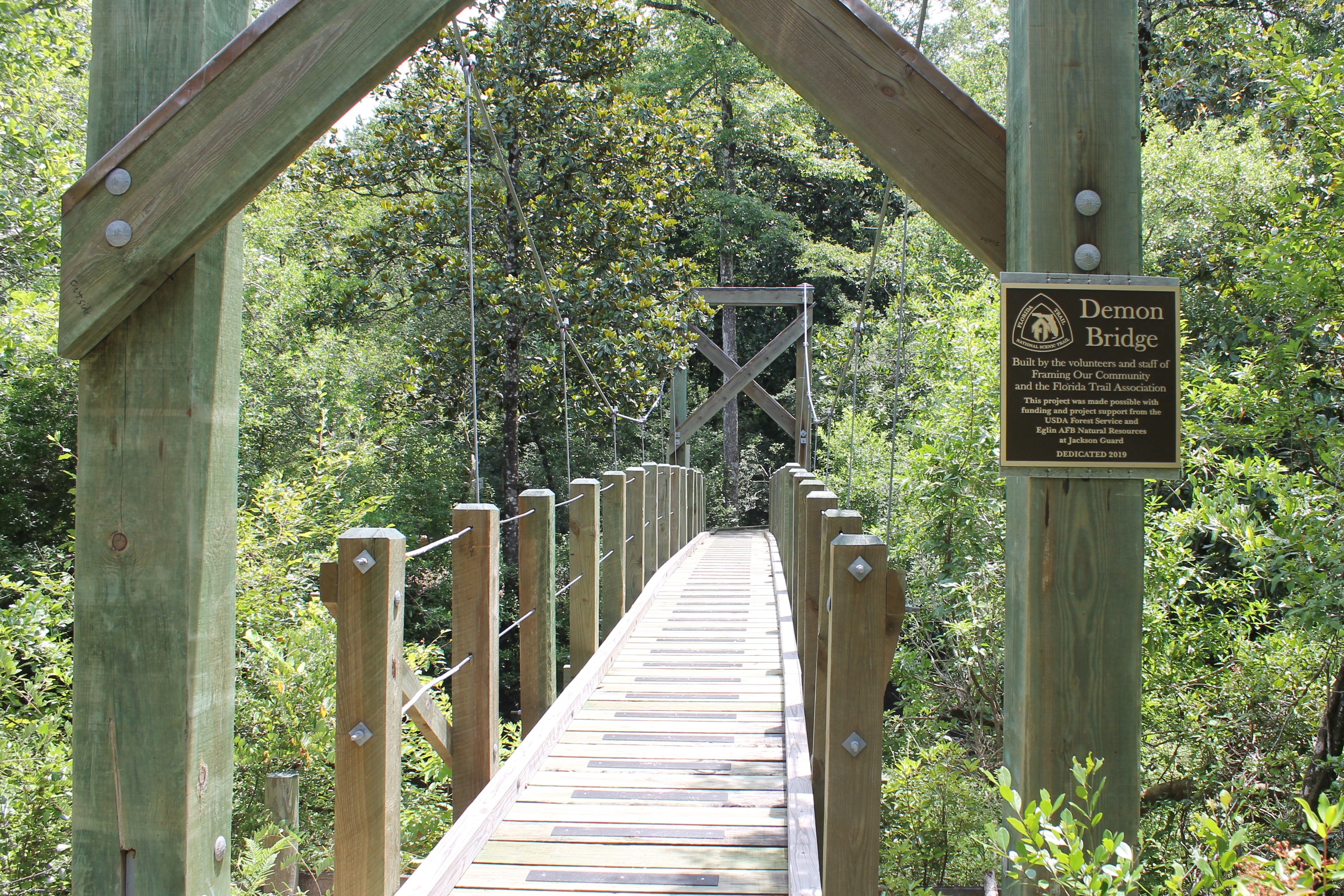
The Eglin reservation is proud to have the Florida National Scenic Trail (FNST) cross portions of the reservation. The FNST runs from Big Cypress National Preserve through the state of Florida to Fort Pickens on the Gulf Islands National Seashore. The Florida Trail Association (FTA) is a volunteer organization that manages and maintains the FNST. Sections of the FNST that traverse the Eglin reservation are maintained by the local chapter of the FTA.
All hikers are responsible for checking the Public Access Map (PAM) for daily closures before entering Eglin AFB. The PAM is located on the iSportsman home page under the "Access Times/PAM" tab; click here). Mission closures (depicted as RED on the PAM) may prevent hiker access to portions of the FNST. However, two sections of the FNST are EXEMPT from PAM closures, provided they are not blocked by signage, range personnel, or barriers. NOTE: When utilizing these exempt portions of the FNST hikers MUST stay on the trail only; failure to do so may result in suspension of recreational access privileges. The only 2 portions of the FNST that are exempt from PAM closures include:
- The portion of the FNST on the east side of the Eglin Reservation (Walton County) traveling through the Brier Creek East Management Unit.
- The portion of the FNST traveling through the portion of the Choctaw West Management Unit west of SR87 (Santa Rosa County). ALL portions of the FNST east of SR87 are subject to PAM closures.
Day hikers (hikers whose journey originates <50 miles from the Eglin boundary) Trail users are required to purchase an Eglin permit to access the FNST. If your hike is overnight a camping permit is also required.
Thru-Hikers (hikers whose journey originates >50 miles outside the Eglin boundary) need to contact Jackson Guard (850-882-4165 or 4166) for special permitting.
The FNST through Eglin is NOT continuous but is broken into sections based on access and existing trails.
Portions of the FNST go through still/stalk and dog hunting management units (Choctaw East, Briar Creek East, Jackson North, Metts, Choctaw West, East River). During hunting seasons there is a possibility of encountering hunters along the trail. It is strongly suggested that during hunting seasons hikers wear highly visible clothing.
Remember: the FNST is for foot traffic ONLY.
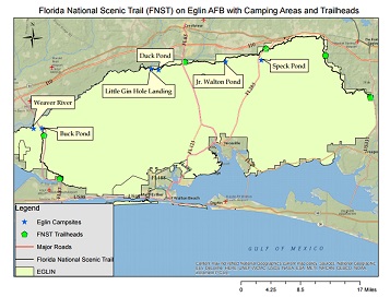
FNST Map
Please see our FNST map with the trail and Eglin Camping Areas.
(FNST camps are not identified on the map, but are listed below.)
FNST Routes
|
|
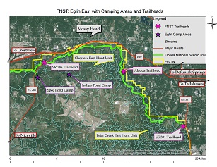
Eglin East + Eglin North: US 331 to Shoal River/SR 85 Trailhead:
The trail begins at the Eglin Portal/US 331 Trailhead on US 331
Eglin Portal Camp 2.9 mi
Alaqua Camp 11.9 mi
Alaqua Trailhead 15.2 mi
Bull Camp 18.7 mi
RR214 25.4 mi (an easy place to get off the trail as-needed)
Red Deer Camp 27.2 mi
SR 285 29.1 mi
Speck Pond Camp 31.4 mi
Jr. Walton Camp 37.6 mi
Pearl Camp 44.3 mi
Shoal River/SR 85 Trailhead on FL 85 N 45.2 mi
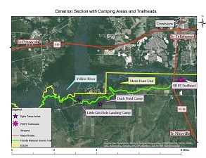
Cimarron Section (not officially part of the FNST): SR 85 to Yellow River:
There is NO bridge across the Yellow River on the Cimarron Section, and hikers should NOT attempt to ford the Yellow River.
The trail begins at Turkey Hen Trailhead (ford the stream)
This trailhead is not shown on the Cimarron Section Map but crosses FL 85 (with caution for traffic) to find it.
RR 211 3.8 mi
RR 610 (close to Duck Pond) 5.4 mi
Duck Pond Camp is located south on RR 610 .25 mi
RR 211 6.1 mi
Turkey Gobbler Creek Rd. 7.2 mi
Yellow River 8.8 mi (no thru-hike, trail ends)
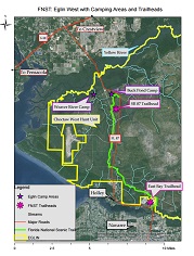
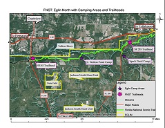
Eglin West: Yellow River Trailhead to East Bay Trailhead
The trail begins at Yellow River/SR 87 Trailhead
Eglin West map appears to show the Trailhead further south of the start, but it is located at the start of the trail.
Buck Pond 2.4 mi
Weaver Creek 6.1 mi
SR 87 9.1 mi
Dean Creek 10.8 mi
Dean Creek Camp 11.2 mi
River Rd. Kiosk 12.4 mi
East Bay Trailhead 14.3 mi
Eglin Campsites near the FNST
Weaver River
Little Gin Hole Landing
Duck Pond
Jr. Walton Pond
Speck Pond
For more information about the Florida Trail Association and the FNST, visit the FTA website: Florida Trail Association
For an interactive map of the FNST, click HERE.